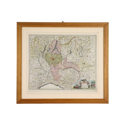
Map of the Duchy of Milan by J. H. Homann Germany XVIII C - Map of the Duchy of Milan
Features
Map of the Duchy of Milan
Artist: Johann Baptista Homann (1664-1724)
Artwork title: Mappa del ducato di Milano
Age: 18th Century / 1701 - 1800
Subject: Maps
Origin: Germany
Artistic technique: Printing
Technical specification: Engraving
Description : Mappa del ducato di Milano
Engraving on paper, in coeval coloring. Bottom right the title "Ducatus Mediolani una cum confinys accurate tabula exibitus auctus et emendatus" and the name of the engraver. The first map engraving was made around 1720 in Nuremberg by the German geographer and cartographer Johann Baptist Homann. It represents the territory of the Duchy of Milan, with the lakes of Como, Maggiore and Lugano in the north, Lake Garda, with Verona and Trento in the north-east, Genoa in the south and Parma, Reggio Emilia and Modena in the south-east. . It is presented in a frame.
Product Condition:
Product in good condition, with small signs of age.
Frame Size (cm):
Height: 69
Width: 78
Depth: 1,5
Artwork dimensions (cm):
Height: 50
Width: 59


